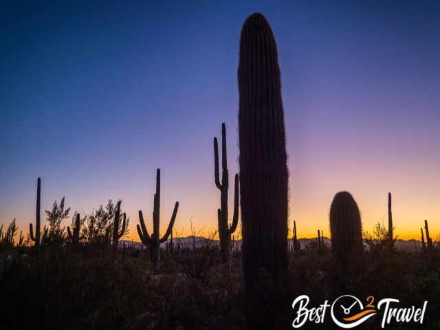
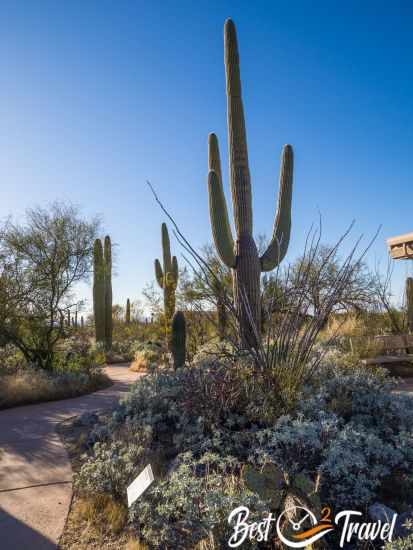
Cacti; saguaros, the park's main attraction, are over a hundred years old and stand like towers in the desert, creating an immense forest. The majestic saguaros are only found in the Sonoran Desert in southwestern Arizona and southeastern California. Without a doubt, this park is definitely worth a visit, but there are significant differences between the two sections. If your time is limited, I recommend visiting the west section. Why? Find all the answers and a link to my YouTube video below.
One of the massive saguaros in the west section.
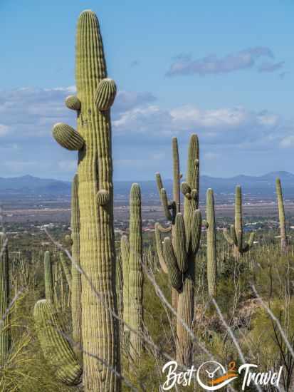
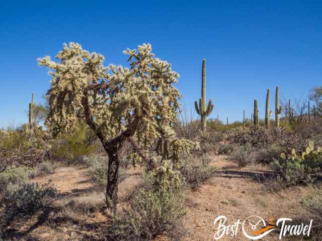
Saguaro National Park is an outstanding park that protects saguaros and cacti forests. Most of the park, 78%, is a wilderness area and accessible only on hiking trails. Tucson City divides this park into two districts, West and East. Getting from one section to the other takes an hour by vehicle. The Park is located in the Sonoran Desert but experiences rain, and that makes a difference.
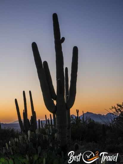
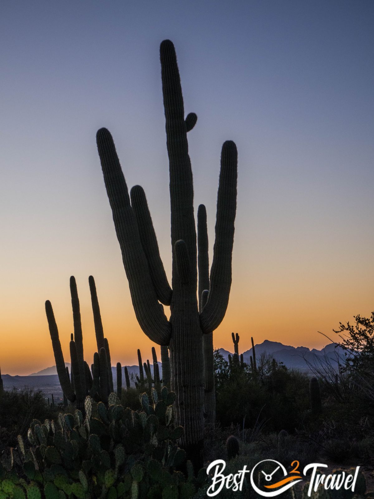
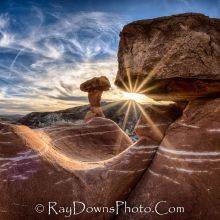
The breathtaking sunset from Signal Hill.
Experience the unique beauty of the Sonoran Desert at Saguaro National Park, home to the majestic saguaros. I’ll guide you through the East and West sections of the park, providing essential details on the most accessible areas, the best spots for cycling, breathtaking sunset views, wheelchair-friendly trails, and locations to admire ancient petroglyphs. Whether you’re short on time or planning a leisurely visit, you’ll be ready to make the most of your next Arizona adventure.
Check out my Table of Contents and get an overview of all essential topics for Saguaro.
The Big Difference Between West and East Saguaro National Park
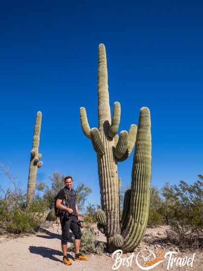
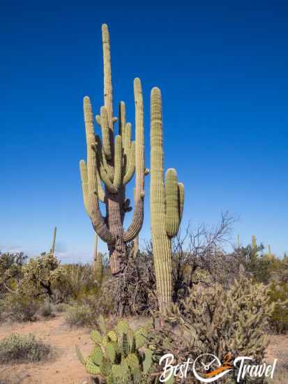
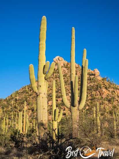
This saguaro in the western part must be over 100 years old and have such arms.
I will give you all the details for both fascinating districts, but first, I’d like to tell you why I like West Saguaro National Park more. This part is located at lower elevations with mountains up to 4,600 ft (1400 m) high. The East Section's highest elevation is over 8,000 ft (2400 m). The higher the park, the more snow and freezing temperatures can be expected in winter.
All these saguaros in the west are over 75 years old.
The West District has a higher density of saguaros, especially older ones with plenty of arms. Saguaros sprout branches “arms” at the age of 75. A cold front brought record-low temperatures to the east in 1937. A few years later, an alarming number of saguaros died. This happened again in 1962 regarding the NPS information panel. Freezing temperatures for more than 20 hours can cause saguaros to die off.
The wheelchair-accessible picnic area and Mica View Trail are in the eastern part.
There are still big and old saguaros in the East section and many smaller ones, but for me, the saguaros in the West District are way more impressive.
A blooming cactus in the western section as early as January.
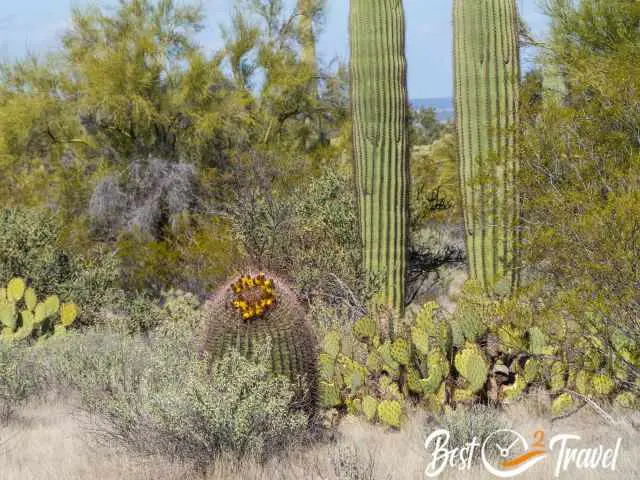
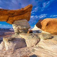
A desert can have a greater variety of plants than a forest. More than 600 plants, mostly cacti, adapted to the harsh conditions in Saguaro, including extreme heat and drought, but struggled with the cold. In summary there are fewer and less massive, old saguaro trees in the east of Saguaro National Park due to freezing temperatures in the winter.
The Best Time to Visit Saguaro National Park
Another old and impressive saguaro in the western part.
The best time to visit Saguaro National Park is from mid-October until March. During these months, day temperatures usually range between 78°F/26°C in early spring and fall and 68°F/20°C in winter. Consider that night temperatures are below 50°F and, in winter, almost freezing. April until mid-October are hot summer months, and heavy monsoon rain occurs in July, August and September. Due to higher elevations, Saguaro East is slightly colder than the West District.
A massive tree cholla along the Cactus Wren Trail in the west.
Saguaros get their white blossoms from late April to May. They are definitely great to see, but I recommend visiting early in the morning to avoid the midday heat above 90°F/32°C in the shade.
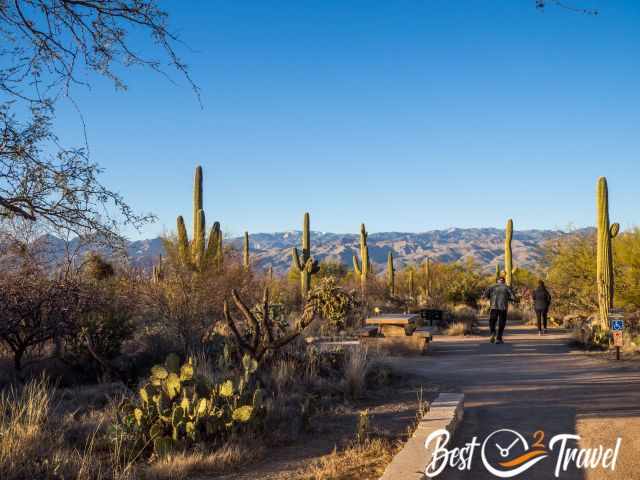
Saguaro National Park West District
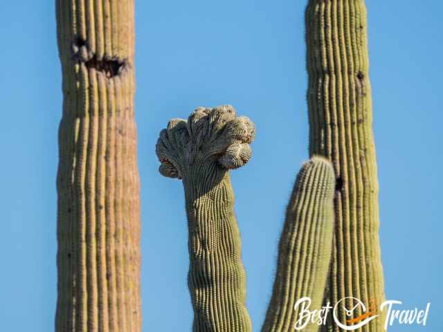
A rare and unique crested saguaro or cristate saguaro - fan-like crown in the western section.
This section of the national park is smaller but offers way more short- and half-day hikes. It is a hundred miles - 1 ½ hour’ drive from Phoenix to this exceptional park section with thousands of impressive saguaros. I couldn’t stop taking pictures from the car and along a hiking trail. Each saguaro is unique, and we were lucky to see a rare, crested saguaro.
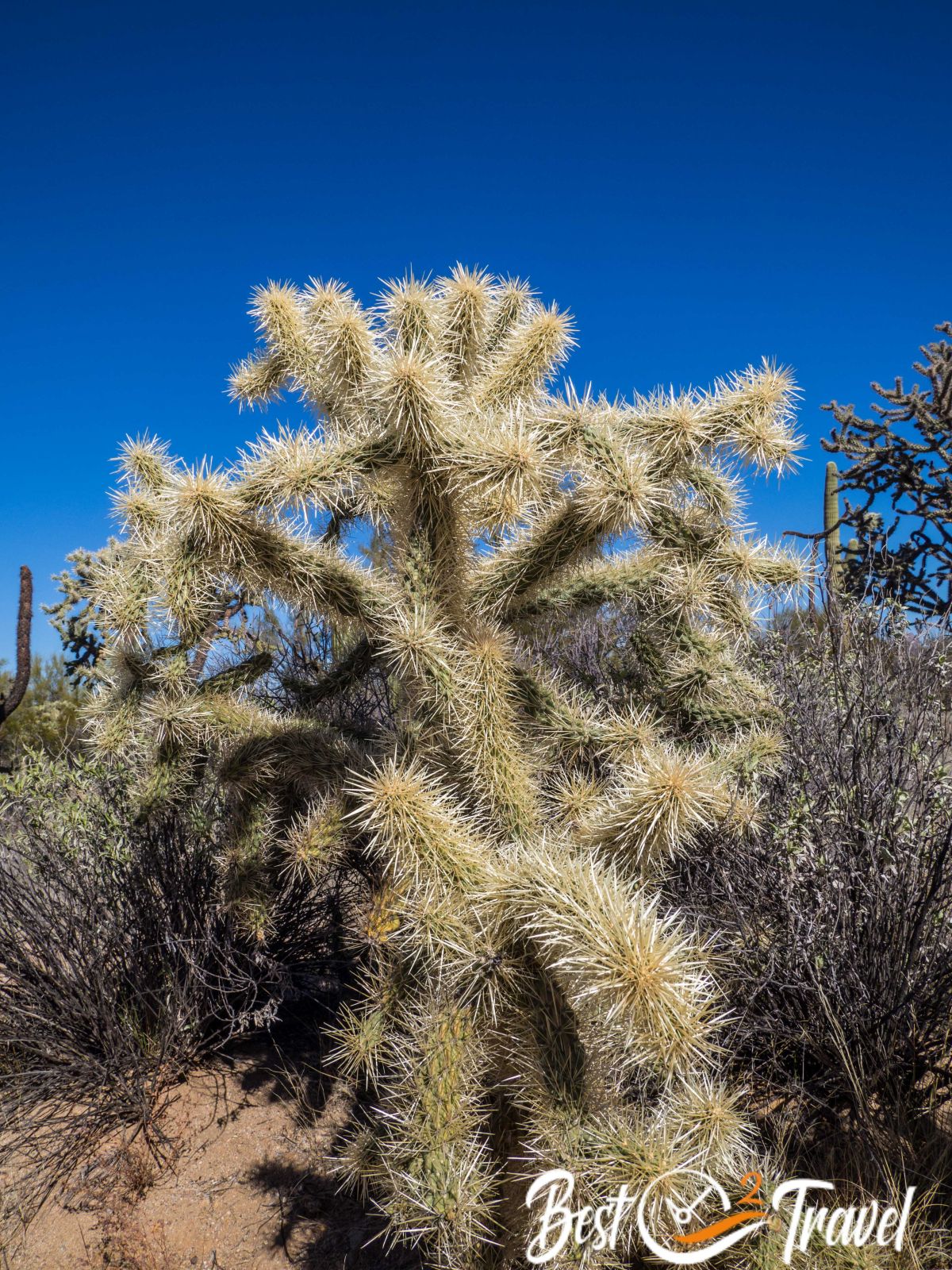
Teddy bear cholla cactus.
The west section has a higher density of old-grown cacti and lusher vegetation because it is located at lower elevations where night temperatures are rarely below freezing in the winter.
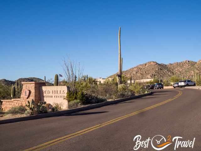
Red Hills Visitor Centre
The Visitor Centre in the West District.
The visitor centre is open from 9 am – 5 pm. Definitely stop here first to grab a map and pay the entrance fee of $25 if you are not an “America, the Beautiful” cardholder. After hours, there is a ticket machine to purchase your entrance ticket, valid for seven days. You can get a leaflet for the entire Saguaro National Park and an additional map for the dirt loop road and hikes. I highly recommend this map full of tips, hikes and their difficulty level. During weekends, attentive and kind volunteers assist the park rangers in answering all your questions.
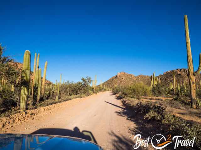
Bajada Dirt Loop Road
The 6-mile gravel loop road.
The dirt loop road is usually accessible by 2WD if you are driving carefully and it is not wet. This loop road leads to the main park section, with beautifully located picnic areas and spectacular views of this awe-inspiring landscape. Even if you cannot walk one of the trails in the park, you get excellent views along the road, and you can watch the sunset from the Signal Hill picnic area.
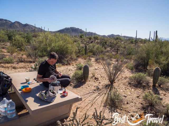
Picnic Areas West Saguaro National Park
All roads and trailheads are well-marked.
Restrooms are available at the mentioned picnic areas.
Not all picnic tables offer shade - Signal Hill.
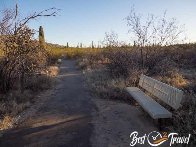
Signal Hill SH
This is one of the best spots for a break. You can walk among these fascinating saguaros and watch the amazing sunset.
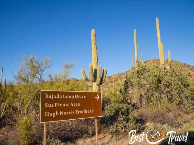
Ez-Kim-In-Zin EZ and Sendero Esperanza EZ which means Hope
Both are located at Golden Gate Road, a turnoff from Bajada Loop Drive. This is the end of the road and the Golden Gate Trailhead.The Ez-Kim-In-Zin picnic area, parking and trailhead for Sendero Esperanza.
Sus
This picnic area is near the Red Hills Visitor Center, a turn-off from Hohokam Road and Loop Drive.
Cam-Boh CB
The picnic area is located in the north along the paved Picture Rocks Road and is easily accessible.
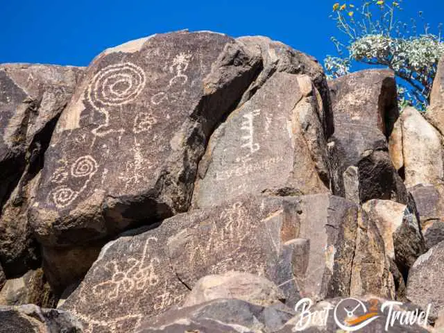
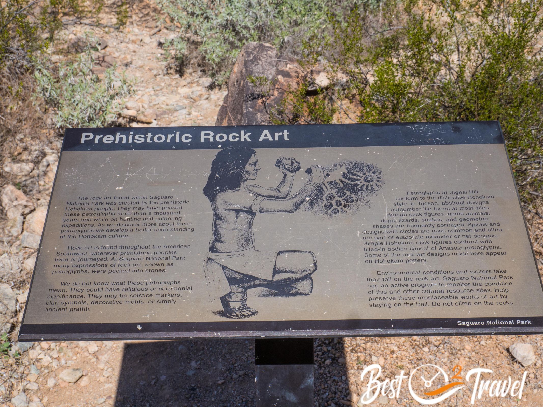
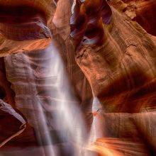
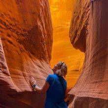
Petroglyphs in West Saguaro
There are petroglyphs visible from both sides.
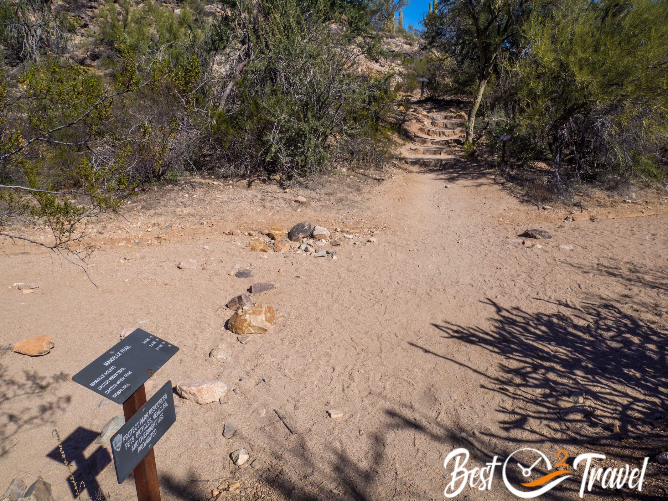
Signal Hill Petroglyphs of the Hohokam people were created more than a thousand years ago. The trail is short, about 0.6 miles roundtrip, through sand and gravel on an unpaved trail with some ups and downs.
Please preserve the petroglyphs and stay on the trail. Do not climb on the rocks.
The hotel is brand new and exceeded our expectations. Very clean, great spacious rooms with a large bathroom, comfy beds and wonderful views of the mountains. The location is very central and easy to reach from the motorways. The staff were very friendly and the internet was super fast. Freshly brewed coffee is available 24/7 free of charge.
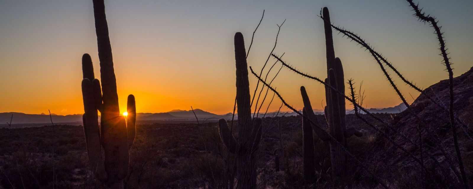
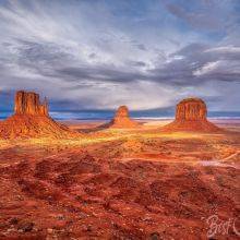
Best Sunset Spots in the Saguaro National Park
A breathtaking sunset at Signal Hill.
An excellent spot is Signal Hill in the Tucson Mountains, in the west section, at a higher elevation, for great views of the valley and sunset.
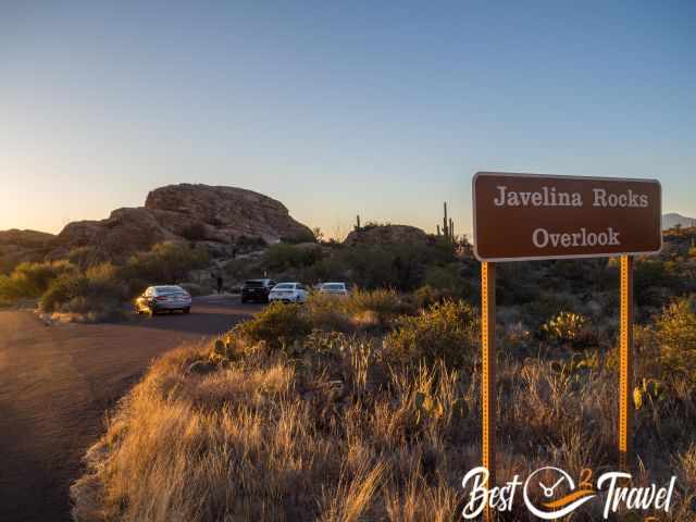
The best spot in the east section is the Javelina Picnic Area, which has breathtaking views of the saguaros and the setting sun. This picnic area is at the end of the paved 8-mile loop, which you can only drive clockwise. If you want to see this unique sunset, plan to drive to this spot at your leisure for about an hour.The small car park at Javelina.It is a 5–10-minute walk from here until you find a suitable spot. Some visitors climb high on the rocks to watch the sunset. We stood behind several saguaros for this fantastic motif. The banner sunset picture at the top of the article was taken from Javelina.
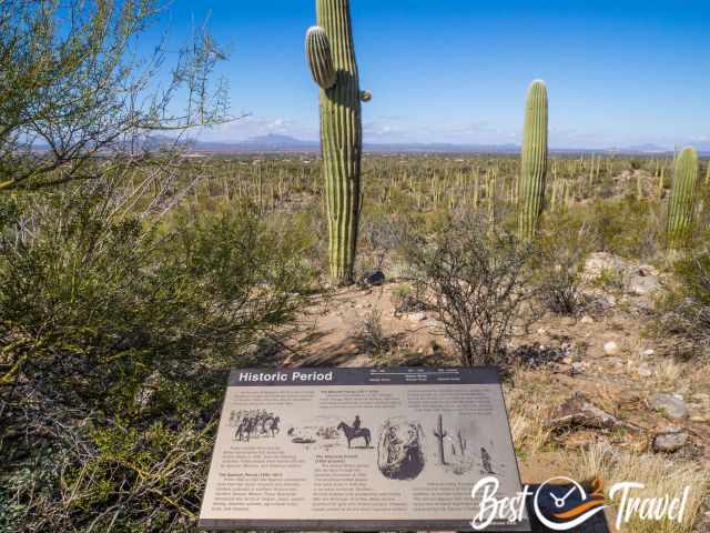
Information panels like the one above are placed at trailheads, picnic areas, and along the interpretive trails.
You've probably noticed how often I've mentioned Signal Hill. There are restrooms, a nice picnic area, and petroglyphs nearby. A fantastic circular hike starts here to admire even more ancient giant saguaros. I highly recommend hiking one of the many trails to discover more of this fascinating landscape.
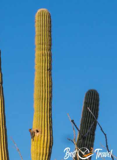
A Gilla woodpecker and nest.
We continued from the petroglyphs on the Cactus Wren Trail and back on the Manville Loop. We saw even more cactus plants, the Gilla woodpecker, which nests here, falcons, and with a bit of luck, the Gila monster – a lizard.
Information panel along the Cactus Wren and Manville Loop hike - jpg high resolution
Trail length: 4.3 miles/ 7 km
Duration: It took us more than 3 hours because of the many photo stops and the unique saguaros.
Difficulty: easy to moderate
Saguaro National Park East Section
The wheelchair-accessible Desert Ethnobotany Garden.
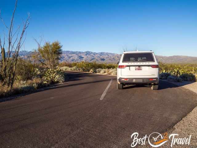
This section of the national park is more extensive and offers an 8-mile scenic paved loop road, which is also popular with cyclists. It’s a narrow, one-way road. The Saguaro East section and the Rincon Visitor Center are a short drive from Tuscon City and an hour's drive from the West section and Signal Hill.
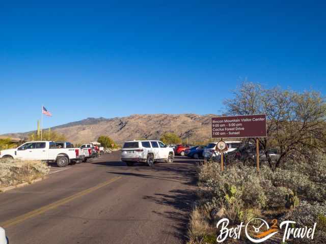
Rincon Visitor Centre
The Visitor Centre is open from 8 a.m. to 4 p.m. from June to September in the hot summer months and from 9 a.m. to 5 p.m. the rest of the year when temperatures are more pleasant. You can get maps and information provided, and a gift shop is inside. The Desert Ethnobotany Garden at the visitor centre is wheelchair accessible.
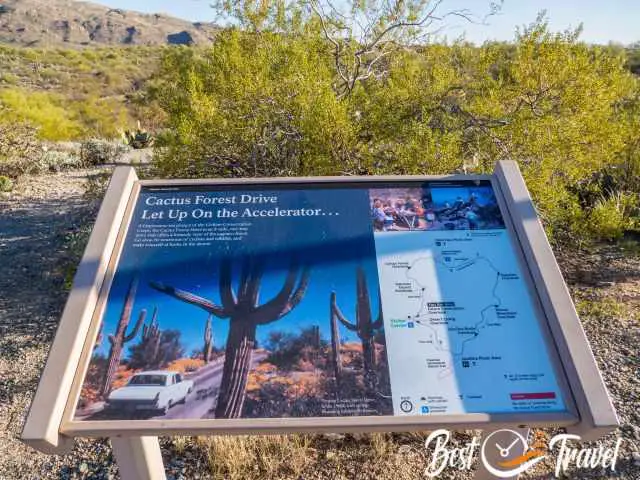
8-Mile Paved Loop Road - Cactus Forest Drive
The 8-mile Loop Road has several bays to admire the landscape.
We have planned 2 hours to enjoy the Loop Drive in leisure. First, you can get to the Mica View picnic area, where several hiking trails start. The short and informative Desert Ecology Trail is accessible for wheelchair users, too.
The wheelchair-accessible "Desert Ecology Trail" in the east.
There are always small bays to stop and admire the impressive landscape. The last stop and the best place to watch the sunset is the Javelina Picnic area. There is limited parking, therefore, I recommend arriving a little earlier.
Opening Hours Saguaro National Park East
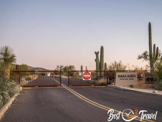
No access to the east section after sunset.
This park section is open from sunrise to sunset. After opening hours, the gate closes, and you can’t access the park section any longer. The west section is not closed by a gate.
Must Know Packing Tip
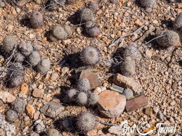
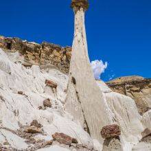
These young cacti "fish-hook barrel" are easily overseen.
If you are on one of the many hiking trails in Saguaro, always pay attention to where you are walking. Many young and still very small cacti can get their spines caught in your shoe, or you can get tangled up. The best way to remove the spines is with a comb.
8 Amazing Facts About the Saguaro Cacti
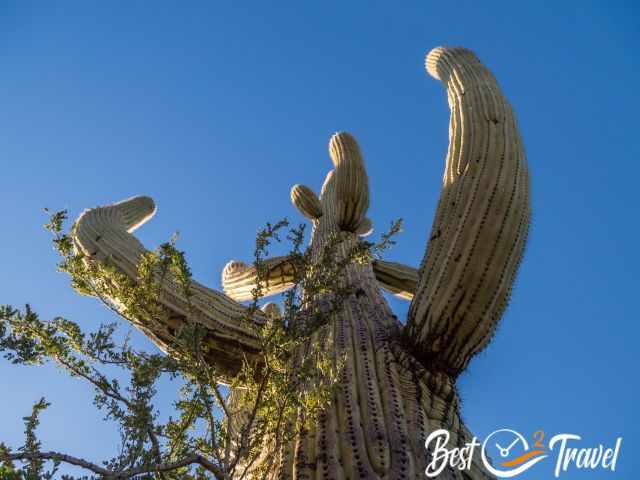
Saguaros at the Hugh Norris Trailhead in the west.
It is the largest cactus in the US.
They can reach a height of 50 ft and more.
The branches of a saguaro arise from the same level, but of course, exceptions occur.
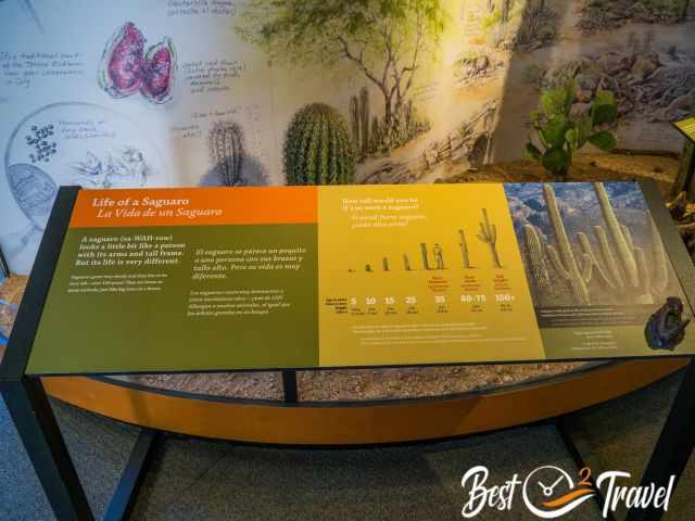
Saguaros flower for the first time at the age of 50 years.
Flower season is from late April to early June. They only flower once from the evening until the next afternoon and will not reopen again.
After pollination, fruits are formed from green to purplish red.
The saguaro trees are an important nesting site for the Gilla woodpecker. Most saguaros have holes at a higher level. When the woodpeckers leave their nests, other birds like the cactus wren take them over. Cactus wrens are the official state bird of Arizona.
Gila woodpeckers carve holes – nests into the spongy flesh. These nests are 15 degrees cooler in summer and stay warmer in winter.
The Signal Hill parking, trailhead and picnic area at the end of the gravel road.
FAQ – Saguaro National Park
What is the best time to visit Saguaro National Park?
The best time to visit is from November to April when temperatures are mild. Spring offers blooming saguaros and pleasant hiking conditions.
How long do you need for Saguaro National Park?
You can explore one district in half a day. A full day lets you visit both the Rincon Mountain District and the Tucson Mountain District.
When do saguaros bloom?
Saguaros bloom from late April to early June. The peak usually occurs in May.
Can you drive through Saguaro National Park?
Yes, both districts offer scenic drives with many short walks and viewpoints along the way.
Are there dangerous animals in Saguaro National Park?
Yes, you may encounter rattlesnakes, scorpions, or javelinas. Stay on marked trails and watch your step.
Do you need a reservation for Saguaro National Park?
No reservation is required. You can enter both districts at any time of day during the opening hours.
Is Saguaro National Park good for hiking?
Absolutely. The park offers easy desert walks, moderate trails, and longer routes into the Rincon Mountains.
What is the difference between the two districts?
The Tucson Mountain District has denser saguaros and classic desert scenery. The Rincon Mountain District is larger, higher in elevation, and offers longer hikes.
Saguaro National Park in the Sonoran Desert is an outstanding park, which Tucson City divides into the East and West districts.
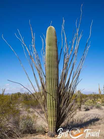
The saguaro is grown protected by an ocotilla.
I will provide comprehensive information for you for the West and East sections of Saguaro, including which part to visit if you are limited in time, where are more impressive saguaros and why, the accessibility, which can be explored by bike, where to catch the breathtaking sunset, wheelchair-accessible paths, and where to marvel at the petroglyphs. This way, you'll be well-prepared for your visit.
Learn everything about saguaros in the visitor centres.
Who We Are
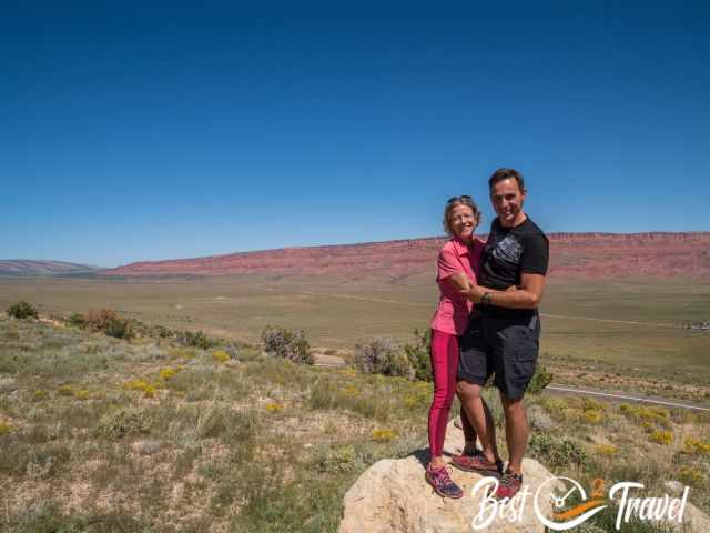
We, Markus and I in the Vermillion Cliffs Wilderness in 2023.
We are passionate travellers, married for 25 years, and we love discovering hidden gems around the globe. I am passionate about sharing some of the most beautiful places in the world with you, but I still can't live from my work, and we have regular jobs, too.
It is a tough business nowadays because fake travel websites rewrite content by AI without effort and expense. Do you like to know more about fake travel websites and how to unmask them? Check out "The Truth About Fake Travel Websites"
Do you like my Saguaro Guide? Please share it with your friends and on social media, subscribe to our YouTube Channel.
Do You Like to Support Me - It's easy; use the Paypal Button below 😍 TIA
Do you want to obtain the usage right for my images? Contact me, but I will take action against picture theft.