
When Is the Best Time
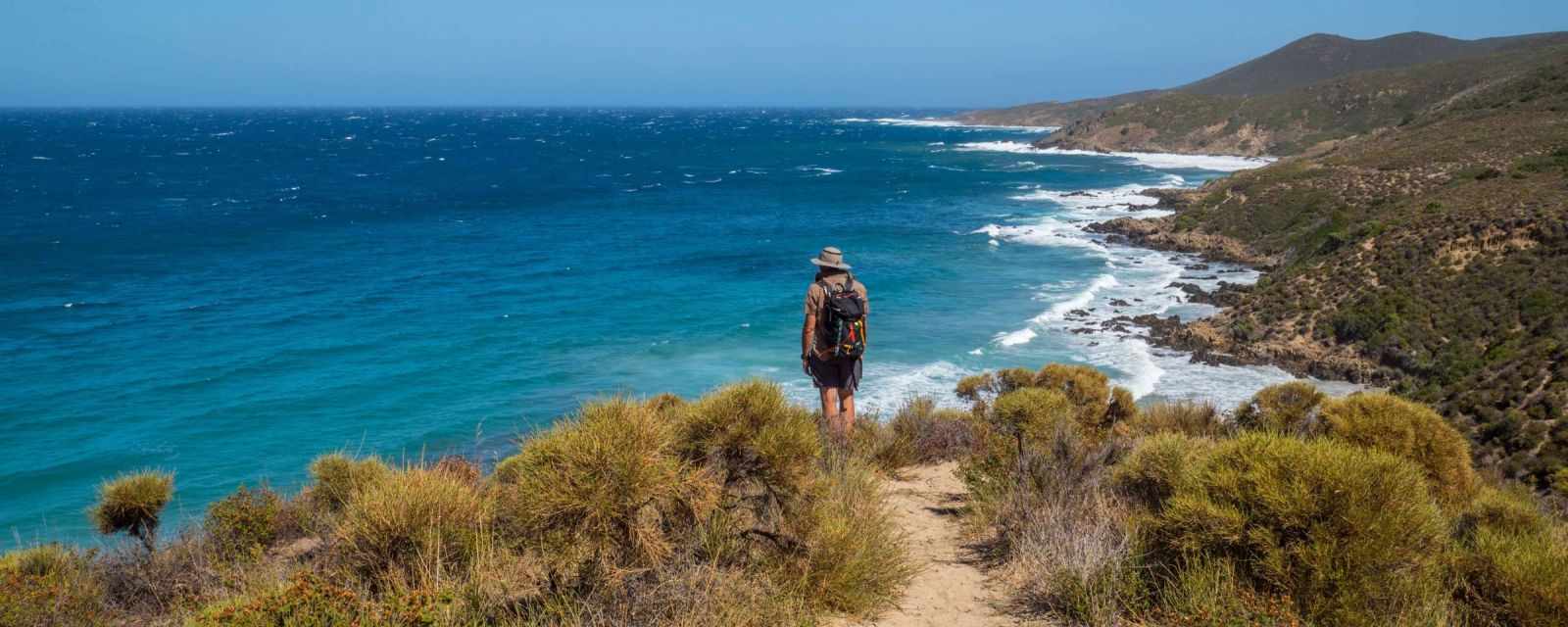
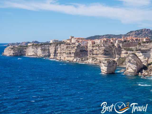
Corsica is a paradise for hikers and is called the island of beauty, and for good reason. Corsica is diverse with stunning coastlines, wild mountain vegetation and excellent hiking trails. With three million tourists annually, you might think the trails are overcrowded, but outside the summer it's not. We also discovered some of the lesser-known hikes and soaked up the magnificent landscapes.
Best Time to Visit
July and August are the peak season, just like everywhere else in Europe. These months are too hot for hiking and with 50%/ approx. 1.5 million visitors in these two months, the trails are overcrowded, and the roads are jammed.
April to June and September and October are the best months for exploring this beautiful island.
Winter could be a quiet and great time too, but many restaurants, hotels and most campgrounds are closed.
Mediterranean Water Temperatures
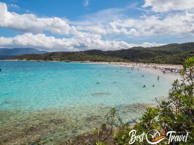
However, those who also want to swim should prefer September or October with water temperatures of around 23°C in September and around 21°C in October (temp. in 2024, rising steadily due to climate change). In April and May, the water is still quite fresh at around 16-18°C. However, you should know that the sea is warmer in the east than in the west as the east coast is close to the Italian mainland.
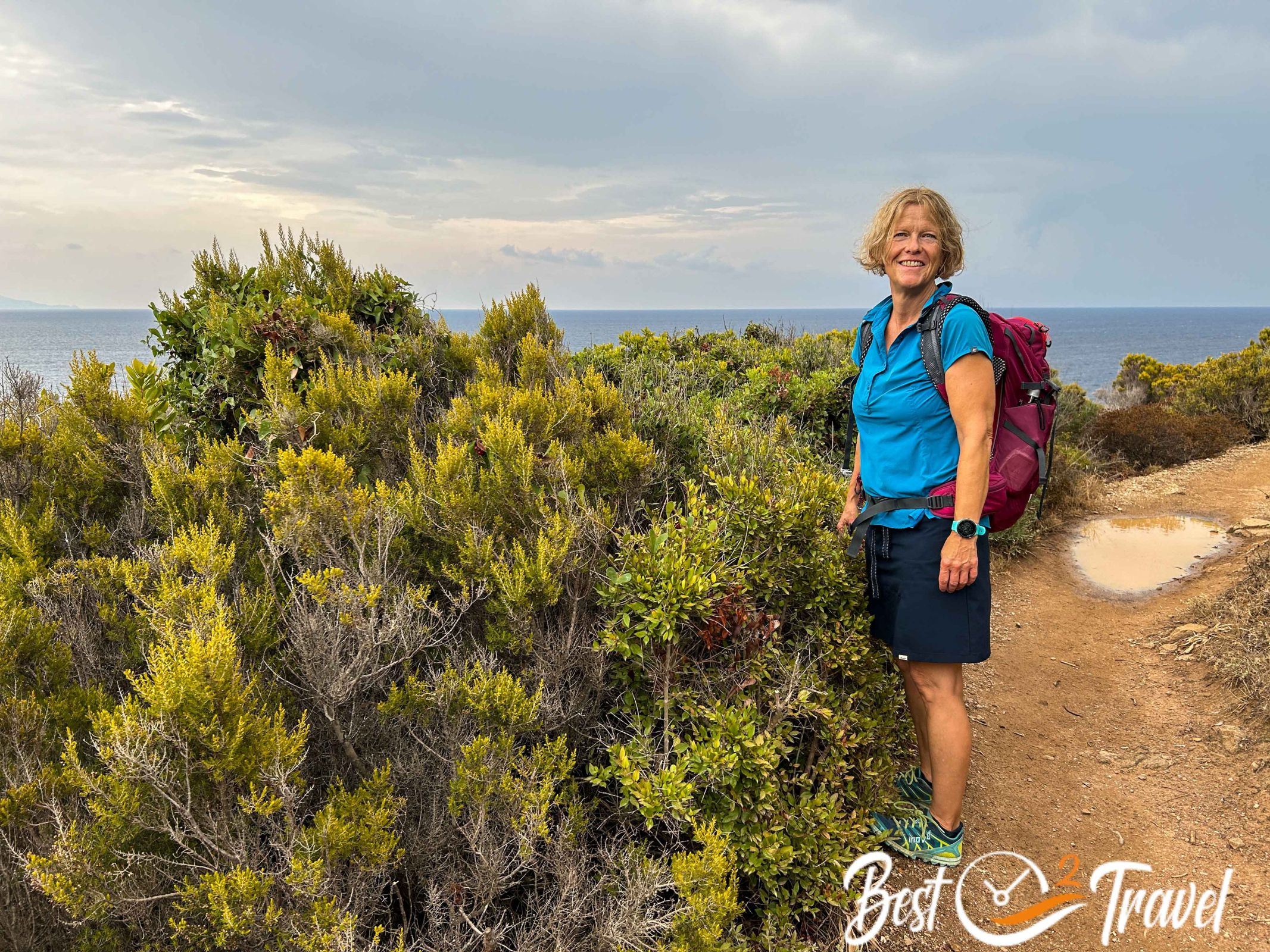
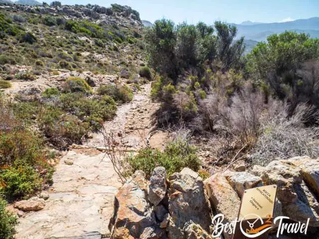
Hiking Trails in Corsica in General

Most of the trails are well-marked, but the hiking time indicated is extremely ambitious in my opinion and others we met on the tours felt the same way. The hikes are marked, but you always have to add at least half an hour to an hour of walking time without breaks.
Our Top 7 Hikes in Corsica
These are our favourite hikes. For some tours, as they are too extensive for this guide, I have added a separate hiking description. So just follow the links for more details.
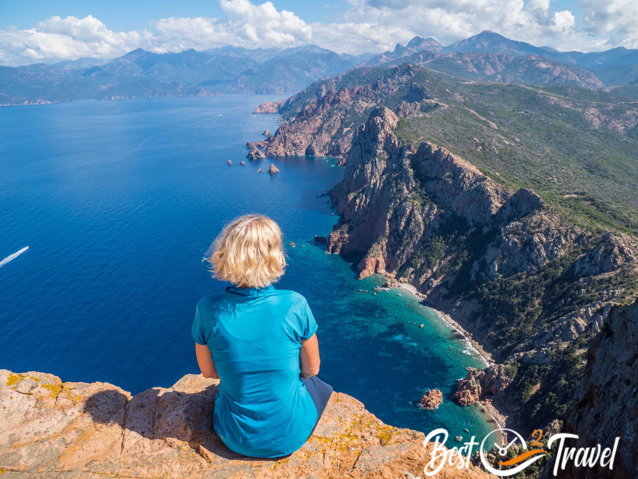
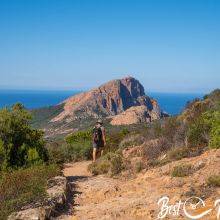
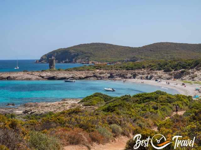
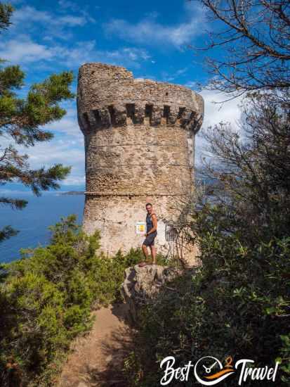
1. Capo Rosso – The Genoese Tower Torra di Turghju

This hike offers breathtaking views of Corsica's wild and pristine coastline. Here, too, you will encounter the glowing red rocks of the Scandola Nature Reserve, with the only difference being that hiking is permitted here. (Scandola can only be explored by boat tour.) The view from the end point of the hike, the Genoese tower: Torra di Turghju, is one of the most spectacular we have ever seen, and we would even compare it to the Kalalau Trail in Hawaii.
Detailed hiking description for Capo Rosso
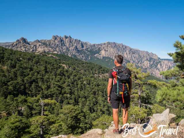
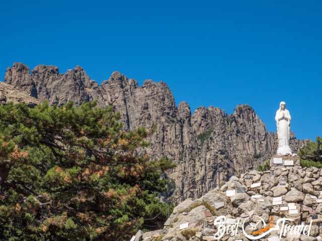
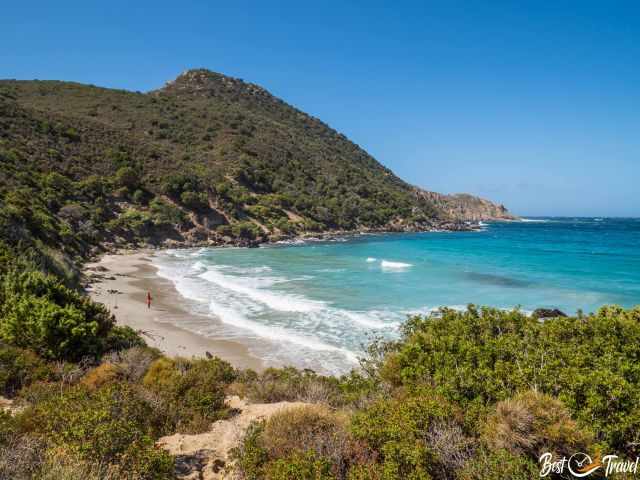
2. Trou de la Bombe – Col de Bavella
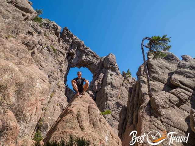
An easy hiking trail that offers spectacular views and turns into a climbing tour at the end to get closer to the wide, almost circular rock hole “Trou de la Bombe”. Most hikers choose the same way back, but there is also the option of a circular tour. This leads past the Dame-Jeanne rock and the Fontaine di a Cannone pilgrimage chapel.
The parking lot is way too small, as several hikes and climbing tours start from here: Link Google Maps
We were forced to park about 2 km away and we took our bikes.
- Distance: half-day round trip 10.5 km
- Length: 2 ½ hours plus breaks
- Elevation gain: approx. 150 m
- Difficulty level: Medium - not well signposted
- Take snacks and plenty of water with you. The hike is located on higher elevation and leads partly through the forest therefore also suitable in summer.
My top B&B recommendation, only 5 km drive to the parking lot and trailhead is the cozy Auberge U n'Antru Versue. Thanks for booking via my website. With your support I am able to provide all these information for free.
3. Sentier des Douaniers
Beautiful coastal tour along the old customs officers' path, who used to search for smugglers here. This hike on the less visited Cape Corse is a relatively easy tour.
Detailed hiking description for Sentier des Douaniers.
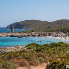
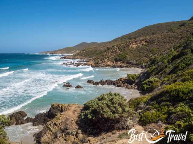
4. Sentier Littoral to the Plage de Acciolu Beach
This is actually a 35 km hike, which is split over three days and ends in St. Florent. We opted for the first section to the beautiful beach at Plage de Acciolu. An absolutely magnificent hike, even if not very well signposted, the views are phenomenal. In terms of the landscape, we had the feeling we were at the Cape in South Africa or in Australia close to the Great Ocean Road. If you like to share the unique nature with just a few hikers, then you've come to the right place.
This tour used to be a circular hiking trail, but it no longer exists, so you hike roughly the same way back or further to Ghignu, the first stage of this trail.
The starting point alone, where the trail begins, offers a fantastic view of the bay, the dune landscape and the beach of Ostriconi. Google Maps link from where I took the photo below. Here, on the old road, a path leads down to the beach.
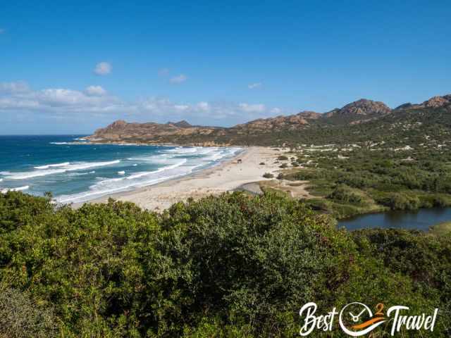
The Sentier Littoral leads through the wild protected area “Désert des Agriates” along the breathtaking coast and the hinterland covered with maquis and junipers. The hike took us to the beautiful but little-known Plage de Acciolu beach. The view down to the bays and beaches is magnificent and once we reached the bottom, the view of the sea was simply stunning, and we took a long break.
- Distance: Half-day hike 15 km, whereby I can only recommend spending a few hours on this deserted and breathtaking beach.
- Length: 4-5 hours
- Elevation gain: insignificant, roughly 100 m down to the beach.
- Difficulty level: Medium - not very well signposted, but an easy path that often branches off. We were glad to have a hiking app on our mobile phone.
- Parking and trailhead Google Maps
- Carry plenty of water, snacks and sun protection in your backpack. There is almost no shade on this tour either.
My accommodation tip: Stay overnight in the nearest village in Belgodere. The village has a great bakery and a well-stocked Spar.
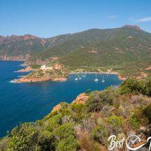
5. Girolata
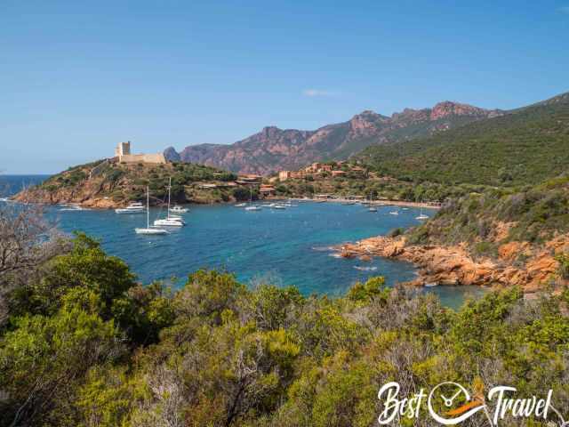
Girolata, a small fishing village on the west coast, is secluded and is only reachable on foot or by boat. There is no access road.
All about this Must-Do hike to Girolata can be found here.
6. Capu di Muru or Capo di Muro
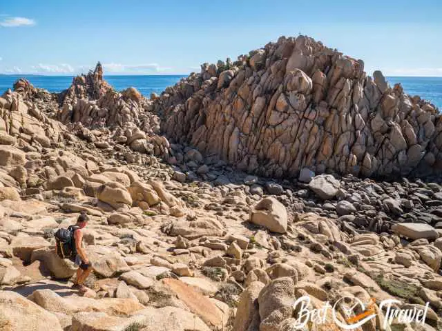
If I had to describe this hike in one sentence; the rock formations and magnificent views are out of this world. If you like hiking off the beaten track, this is the place for you.
The first part leads to the Genoese Tower at Capo di Muru and is fairly well-known, but not the complete loop around the cape. The tower is not accessible, the Omigna is (see no. 7). From here you have a good view of Ajaccio and the Parata peninsula. It's a nice walk, but I only recommend hiking here if you do the entire loop trail.
Most visitors hiked back the same way and missed the best part. Instead, we continued along the coast and were rewarded with a breathtaking rocky landscape.
From the starting point, the path branches off after about three quarters of an hour and leads to the tower on the right and to Muru Cape to the left. We first hiked to the tower and then continued to Capo di Muro.
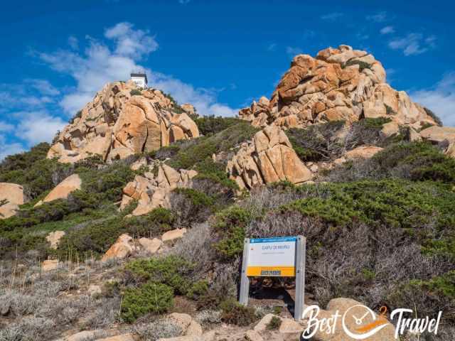
The path to the tower mostly leads over dry and dusty ground past myrtle bushes, from which the aperitif with the same name is made of. The second part, on the contrary, is much rockier, uneven and poorly marked. Be sure to pack your swimming gear. There are some excellent places to swim in the Mediterranean.

We followed the path along the rocky coast, where we repeatedly came across bushy passages. At the end, we returned to the main path and hiked about 30-45 minutes back to the road where our van was parked.
- Length: All-day tour 13 km approx. 4 ½ hours plus breaks
- or to the tower and back 5.6 km
- Elevation gain: approx. 490 m for the circular tour
- Difficulty level: Medium - not well-marked around the cape
- Take snacks and plenty of water with you, wear sun protection. There is almost no shade.
- Take your swimwear with you in your day pack.
- Parking and trailhead Google Maps
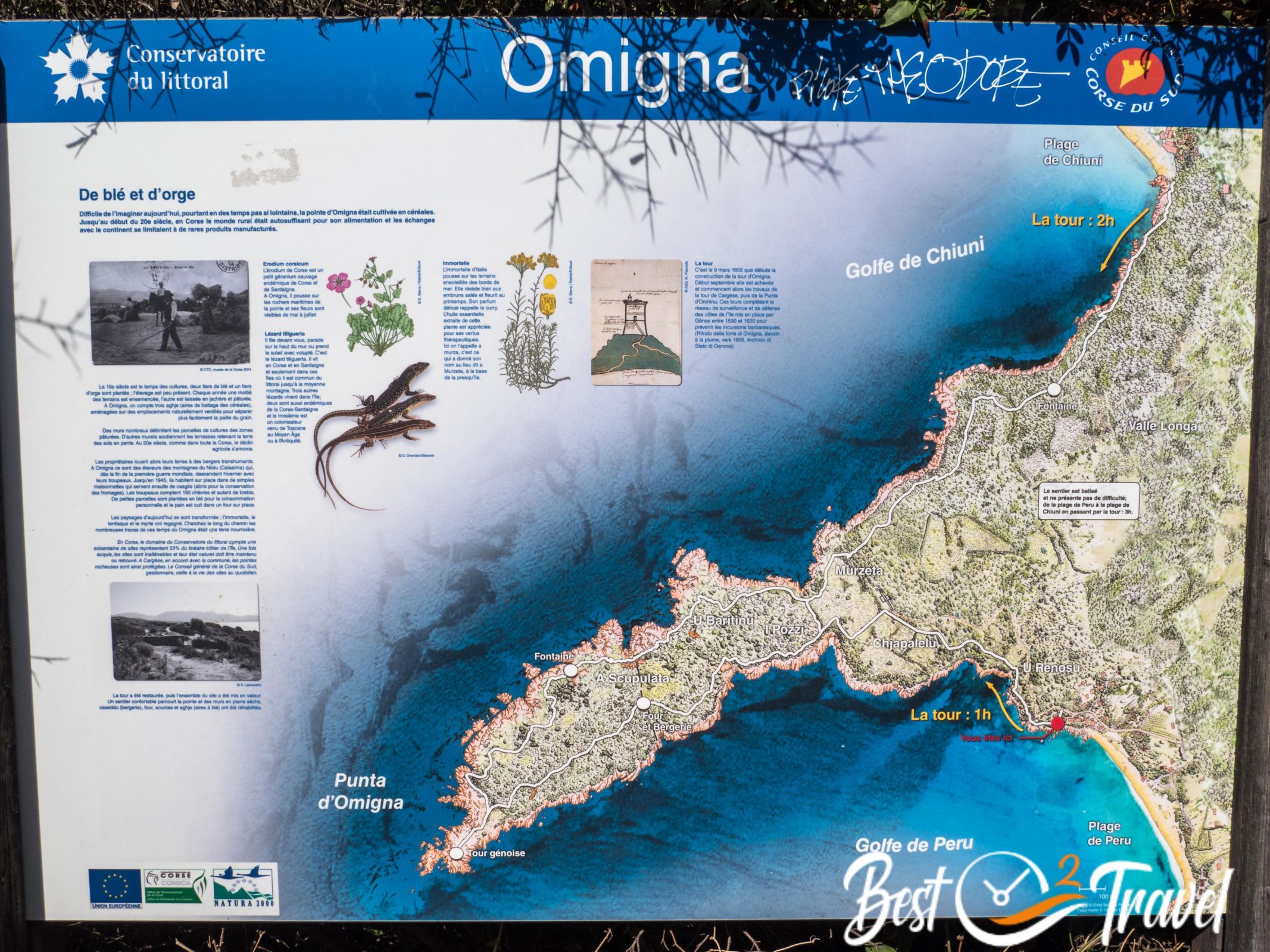
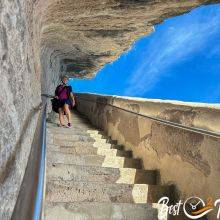
7. Tour Genoise d’Omigna in Cargese

A short, easy but enjoyable walk that is suitable for almost everyone. The highlight of the trail is the restored Genoese tower from the 16th century, which is open to the public. You can hike there and back on the wind-protected side or as a circular tour around the cape. The sunset from here is guaranteed to be magnificent and the way back is easy by torchlight.

- Distance: approx. 6.5 km
- Length: half-day tour approx. 2 hours
- Elevation gain: hardly any
- Difficulty level: Easy
- Parking: At Peru beach in Cargèse and on the roadside – trailhead Google Maps
- Hiking Map at the beginning of the trail
- Take plenty of water with you and make sure you wear sun protection. It can be very windy here, so a windbreaker or jacket in your rucksack is advisable.

My restaurant tip for or after the walk with a fantastic view of the tower in the distance is the Restaurant U Lustincone at the end of Plage de Peru beach. Link Google Maps
Hotel Tip; Hôtel et Résidence Ta Kladia directly located at the beach with an amazing view to the Omigna peninsula and tower.
The History of the Genoese Towers – How many Genoese Towers has Corsica?

One of the main attractions along the Corsican coast are these historic towers. Several of the hikes I recommend lead to such monuments, which is why I'd like to provide a bit more detail. These defense structures were built in the 16th century to protect the coast and villages from barbarian raids. In 1530, there were just 32 towers in Corsica, and a year later, 90 more were planned.
Two hundred years later, Corsica had nearly 120 towers, 30 of them on Cap Corse alone. However, some were destroyed and others succumbed to the weather. Today, only 67 towers remain along the coast, mainly in the west and on Cap Corse, and they are one of the highlights for hikers.
Who We Are
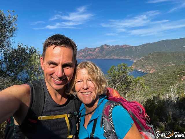
We are passionate travellers and hikers, married for 26 years, and we love discovering hidden gems around the globe. I love sharing some of the most beautiful places in the world with you, but I still can't live from my work, and we have regular jobs, too.
It is a tough business these days because fake travel websites rewrite content without effort and expense with the help of AI. Do you like to know more about fake travel websites and how to unmask them? Check out "The Truth About Fake Travel Websites"
Do you like my Corsica Guides? Please share it with your friends and on social media, and subscribe to our YouTube Channel.
Do You Like to Support Me - It's easy; use the Paypal Button below 😍
Do you want to obtain the usage right for my images? Contact me, but I will take action against picture theft.
Best Months to Visit
Location and Tips

Corsica, the so called island of beauty is a fantastic destination for hiking, swimming in the Mediterranean sea, for foodies, camper, adventure seeker and everybody else. Even if French or Corsican is the national language, you can get on well with English and partly also German. We really fell in love with this island and that's why I want to share some of the most beautiful places with you.